


Maps that Mattered

From the voyages of discovery down to our own day, maps have influenced American history.
A History of America in 100 Maps explores these fascinating stories through an array of brilliant, full color images.
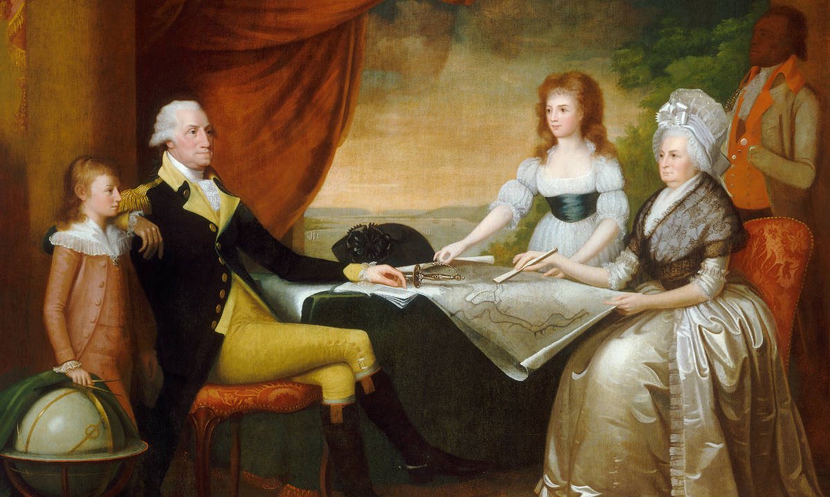
Edward Savage captured George Washington and the first family gathered around a map of the newly proposed capitol in the 1790s. The plan for Washington, D.C. was widely reproduced in the United States and Europe, and quickly became an iconic symbol of American independence. As an aspirational statement of the nation's future, the plan of Washington, D.C. is just one example of the role that maps have played in a American history.
Seeing the Past through Maps
Throughout its history, America has been defined through maps. Whether made for military strategy or urban reform, to encourage settlement or to investigate disease, maps invest information with meaning by translating it into visual form. They capture what people knew, what they thought they knew, what they hoped for, and what they feared. As such they offer unrivaled windows into the past.
In this book, Susan Schulten uses one hundred maps to explore five centuries of American history. Each is discussed in terms of its specific features as well as its larger historical significance in a way that conveys a fresh perspective on the past. Some of these maps were designed by established figures as tools of statecraft and diplomacy. Yet equally revealing are those made by lesser known figures, such as Cherokee tribal leaders, soldiers on the front, and the first generation of girls to be educated outside the home. Considered together, they showcase the power of maps to illuminate and complicate our understanding of the past.
Audacious in scope and charming in execution, A History of America in 100 Maps offers an engaging visual tour through the past.

About the Author

I am a historian at the University of Denver, where I have taught since 1996. I wrote two earlier books that investigated the powerful role of maps in American history: The Geographical Imagination in America, 1880-1950 (2001) and Mapping the Nation: History and Cartography in Nineteenth-Century America (2012). You can learn more about my research here.
Mapping the Nation traced the ways that maps and the thinking behind them transformed during the nineteenth century. To illustrate the power of this shift, I developed a site that showcased the maps from the book in high resolution. Today we live in a world saturated with maps and graphic information. If you're curious about how we got here, check out mappingthenation.com
This site was supported by the University of Denver's Office of the Provost as well as the Dean of Arts, Humanities, and Social Sciences. The site was designed by Alek Lisefski at Followbright, and developed by Jeff Rynhart.